California Historical Landmarks located in Plumas County, California are listed.
Note: The map coordinate for each historical landmark is a link to a map showing its location.
| Image
|
[1]
|
Landmark name
|
Location
| City or town |
Summary
|
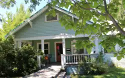 American Ranch and Hotel American Ranch and Hotel
|
479
|
American Ranch and Hotel
|
355 Main St.
39°56′13″N 120°56′43″W / 39.93701°N 120.945323°W / 39.93701; -120.945323 (American Ranch and Hotel)
| Quincy |
|
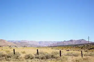 Beckwourth Pass Beckwourth Pass
|
336
|
Beckwourth Pass
|
Rest area, Beckwourth Pass
39°47′30″N 120°06′28″W / 39.791667°N 120.107778°W / 39.791667; -120.107778 (Beckwourth Pass)
| Chilcoot |
|
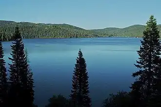 Bucks Lake Bucks Lake
|
197
|
Bucks Lake
|
Bucks Lake Lodge Marina
39°52′45″N 121°10′34″W / 39.87915°N 121.176183°W / 39.87915; -121.176183 (Bucks Lake)
| Bucks Lake |
|
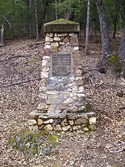 Elizabethtown Elizabethtown
|
231
|
Elizabethtown
|
On dirt rd, 0.4 mi NW of State Hwy 70
39°57′50″N 120°57′25″W / 39.963839°N 120.957081°W / 39.963839; -120.957081 (Elizabethtown)
| Quincy |
|
 Jamison City, Eureka Mills, Johnstown, and the famous Eureka Mine Jamison City, Eureka Mills, Johnstown, and the famous Eureka Mine
|
196
|
Jamison City, Eureka Mills, Johnstown, and the famous Eureka Mine
|
Plumas-Eureka State Park
39°47′18″N 120°38′04″W / 39.788383°N 120.634317°W / 39.788383; -120.634317 (Jamison City, Eureka Mills, Johnstown, and the famous Eureka Mine)
| Blairsden |
|
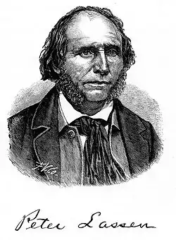 Peter Lassen Marker Peter Lassen Marker
|
184
|
Peter Lassen Marker
|
North Valley Rd.
40°08′59″N 120°52′46″W / 40.149717°N 120.87945°W / 40.149717; -120.87945 (Peter Lassen Marker)
| Greenville |
|

Upload Photo
|
212
|
Pioneer Grave
|
Buck's Lake Rd.
39°51′49″N 121°13′37″W / 39.863517°N 121.226833°W / 39.863517; -121.226833 (Pioneer Grave)
| Quincy |
|
Upload Photo
|
625
|
Pioneer Schoolhouse
|
Plumas County Fairgrounds
39°56′20″N 120°54′56″W / 39.938933°N 120.915617°W / 39.938933; -120.915617 (Pioneer Schoolhouse)
| Quincy |
|
 Johnsville Ski Area Johnsville Ski Area
|
723
|
Johnsville Ski Area
|
Plumas-Eureka State Park
39°45′24″N 120°41′52″W / 39.756617°N 120.697683°W / 39.756617; -120.697683 (Johnsville Ski Area)
| Blairsden |
|
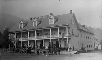 Plumas House Plumas House
|
480
|
Plumas House
|
Main and Court Sts.
39°56′10″N 120°56′53″W / 39.936000°N 120.948000°W / 39.936000; -120.948000 (Plumas House)
| Quincy |
|
Upload Photo
|
213
|
Rabbit Creek Hotel Monument
|
Main and Church Sts
39°40′58″N 120°59′05″W / 39.682883°N 120.9846°W / 39.682883; -120.9846 (Rabbit Creek Hotel Monument)
| La Porte |
|
Upload Photo
|
337
|
Rich Bar
|
Rich Bar, on State Hwy 70
40°00′43″N 121°11′35″W / 40.012017°N 121.193°W / 40.012017; -121.193 (Rich Bar)
| Quincy |
|
Upload Photo
|
481
|
Spanish Ranch
|
Spanish Ranch Rd.
39°57′00″N 121°03′25″W / 39.95005°N 121.056983°W / 39.95005; -121.056983 (Spanish Ranch)
| Spanish Ranch |
|
References
See also
|
|---|
|
|---|
| Parks | |
|---|
| Preserves | |
|---|
| Monuments | |
|---|
| Seashores | |
|---|
| Historical Parks | |
|---|
| Historic Sites | |
|---|
| Memorials | |
|---|
| Recreation Areas | |
|---|
|
|
|
|---|
| Parks | |
|---|
| Natural Reserves | |
|---|
| Marine Reserves | |
|---|
| Historic Parks | |
|---|
| Beaches | |
|---|
| Recreation Areas | |
|---|
Vehicular
Recreation Areas | |
|---|
| Other | |
|---|
|
|
|
|---|
National Forests
and Grasslands | |
|---|
National Wilderness
Preservation System | |
|---|
National Monuments
and Recreation Areas | |
|---|
|
|
|
|
|
|---|
Wildlife
Areas | |
|---|
Ecological
Reserves | |
|---|
Marine
Protected
Areas | |
|---|
|
|
|
|---|
| National Monuments | |
|---|
National
Conservation Areas | |
|---|
| Wilderness Areas | |
|---|
|
|
|
|
|
|
|
|
