List of airports in Prince Edward Island
This is a list of airports in Prince Edward Island. It includes all Nav Canada certified and registered water and land airports, aerodromes and heliports in the Canadian province of Prince Edward Island.[1][2] Airport names in italics are part of the National Airports System.[3]
_2.svg.png)
List of airports and heliports
The list is sorted by the name of the community served; click the sort buttons in the table header to switch listing order.
| Community | Airport name | PU PR MI |
AOE[A] | Operator | Elevation | ICAO | TC LID |
IATA | Image | Coordinates |
|---|---|---|---|---|---|---|---|---|---|---|
| Cable Head | Cable Head Airpark | PR | Michael Whitty | 94 ft (29 m) |
CCA3 | 46°26′36″N 62°35′29″W / 46.44333°N 62.59139°W | ||||
| Charlottetown | Charlottetown Airport | PU | 60 (368)[5] 15[6][B] |
Charlottetown Airport Authority | 167 ft (51 m) |
CYYG | YYG | 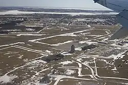 |
46°17′24″N 63°07′16″W / 46.29000°N 63.12111°W | |
| Charlottetown | Charlottetown (Queen Elizabeth Hospital) Heliport | PR | Queen Elizabeth Hospital | 20 ft (6.1 m) |
CDV3 |  |
46°15′20″N 63°05′56″W / 46.25556°N 63.09889°W | |||
| Summerside | Summerside Airport | PU | CANPASS[7] | Slemon Park Corporation | 56 ft (17 m) |
CYSU | YSU | 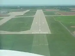 |
46°26′26″N 63°50′01″W / 46.44056°N 63.83361°W | |
| Summerside | Summerside (Prince County Hospital) Heliport | PR | Health PEI | 39 ft (12 m) |
CCH6 | 46°25′04″N 63°46′26″W / 46.41778°N 63.77389°W |
Defunct airports

Notes
- ^ An airport of entry has four different categories. An AOE which can accept "all classes of scheduled and non-scheduled aircraft (passenger and cargo)." An AOE/# which can handle aircraft in the previous category but up to maximum number. This number can be exceeded if done in stages as shown in parenthesis. An AOE/15 that can accept general aviation aircraft with a maximum of 15 passengers. An AOE/CAN which can handle aircraft subject to the CANPASS regulations.[4]
- ^ Seaplanes only.[6]
References

Wikimedia Commons has media related to Airports in Prince Edward Island.
- ^ Canada Flight Supplement. Effective 0901Z 27 November 2025 to 0901Z 22 January 2026.
- ^ Nav Canada's Water Aerodrome Supplement. Effective 0901Z 17 April 2025 to 0901Z 19 March 2026.
- ^ "National Airports System". 25 June 2025. Retrieved 15 October 2025.
- ^ "Memorandum D2-5-1" (PDF). Canada Border Services Agency. 25 February 2015. pp. 3, 4. Retrieved 29 October 2025.
- ^ "Site Name: Charlottetown Airport - CYYG". Canada Border Services Agency. 22 August 2025. Retrieved 30 October 2025.
- ^ a b "Site Name: Charlottetown Marine Terminal - CYYG". Canada Border Services Agency. 22 August 2025. Retrieved 30 October 2025.
- ^ "Site Name: Summerside Airport - CYSU". Canada Border Services Agency. 22 August 2025. Retrieved 30 October 2025.


.svg.png)