Mawathagama East Grama Niladhari Division
Mawathagama East | |
|---|---|
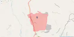 Mawathagama East Grama Niladhari Division | |
| Coordinates: 6°52′16″N 80°05′32″E / 6.871021°N 80.092273°E | |
| Country | Sri Lanka |
| Province | Western Province |
| District | Colombo District |
| Divisional Secretariat | Seethawaka Divisional Secretariat |
| Electoral District | Colombo Electoral District |
| Polling Division | Avissawella Polling Division |
| Area | |
• Total | 2.39 km2 (0.92 sq mi) |
| Elevation | 69 m (226 ft) |
| Population (2012)[2] | |
• Total | 914 |
| • Density | 382/km2 (990/sq mi) |
| ISO 3166 code | LK-1115340 |
Mawathagama East Grama Niladhari Division is a Grama Niladhari Division of the Seethawaka Divisional Secretariat of Colombo District of Western Province, Sri Lanka . It has Grama Niladhari Division Code 444A.
Mawathagama East is a surrounded by the Pitumpe North, Galagedara East, Galagedara North, Wewelpanawa, Diddeniya South, Kudakanda, Mawathagama West and Thunnana West Grama Niladhari Divisions.
Demographics
Ethnicity
The Mawathagama East Grama Niladhari Division has a Sinhalese majority (98.1%) . In comparison, the Seethawaka Divisional Secretariat (which contains the Mawathagama East Grama Niladhari Division) has a Sinhalese majority (88.2%) [2]
- Sinhalese (98.1%)
- Indian Tamil (1.40%)
- Other (0.40%)
Religion
The Mawathagama East Grama Niladhari Division has a Buddhist majority (94.4%) . In comparison, the Seethawaka Divisional Secretariat (which contains the Mawathagama East Grama Niladhari Division) has a Buddhist majority (81.5%) [2]
- Buddhist (94.4%)
- Roman Catholic (2.70%)
- Hindu (1.80%)
- Other (1.10%)
Places adjacent to Mawathagama East Grama Niladhari Division | ||||||||||||||||
|---|---|---|---|---|---|---|---|---|---|---|---|---|---|---|---|---|
| ||||||||||||||||


References
- ^ "USGS EarthExplorer". earthexplorer.usgs.gov. U.S. Geological Survey. 2020.
- ^ a b c d e "Census of Population and Housing 2012". statistics.gov.lk. Department of Census and Statistics, Sri Lanka. 2012.