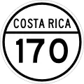
National Route 170 (Costa Rica)
 | ||||
|---|---|---|---|---|
| Ruta nacional secundaria 170 | ||||
| Route information | ||||
| Maintained by Ministry of Public Works and Transport | ||||
| Length | 22.885 km (14.220 mi) | |||
| Location | ||||
| Country | Costa Rica | |||
| Provinces | Alajuela, Guanacaste | |||
| Highway system | ||||
| ||||
National Secondary Route 170, or just Route 170 (Spanish: Ruta Nacional Secundaria 170, or Ruta 170) is a National Road Route of Costa Rica, located in the Alajuela, Guanacaste provinces.[1]
Description
In Alajuela province the route covers Upala canton (San José district).
In Guanacaste province the route covers La Cruz canton (Santa Cecilia district).
References
- ^ "GeoPortal". Ministerio de Obras Públicas y Transporte de Costa Rica. Archived from the original on 22 September 2020. Retrieved 30 May 2020.