Schlappoltkopf
| Schlappoltkopf | |
|---|---|
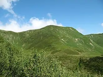 Schlappoldkopf. | |
| Highest point | |
| Elevation | 1,968 m (6,457 ft) |
| Prominence | 4 m (13 ft) |
| Parent peak | nameless P. 1973 (line parent), a subpeak of Fellhorn, 160 m southwest of Schlappoltkopf |
| Isolation | 0.15 km (0.093 mi) to P.1973 |
| Coordinates | 47°21′31″N 10°13′27″E / 47.35861°N 10.22417°E |
| Geography | |
| Location | Bavaria, Germany |
Schlappoltkopf is a minor ridge prominence of Fellhorn at the border of Bavaria, Germany, and Vorarlberg, Austria.[1]
References
- ^ BayernAtlas - Topographische Karte - map view with Schlappoltkopf, retrieved 7 February 2026.