Upper Hyde
| Upper Hyde | |
|---|---|
 | |
  Upper Hyde Location within the Isle of Wight | |
| Civil parish | |
| Unitary authority | |
| Ceremonial county | |
| Region | |
| Country | England |
| Sovereign state | United Kingdom |
| Police | Hampshire and Isle of Wight |
| Fire | Hampshire and Isle of Wight |
| Ambulance | Isle of Wight |
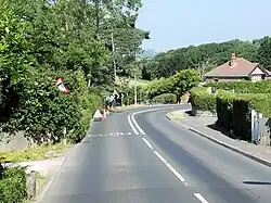
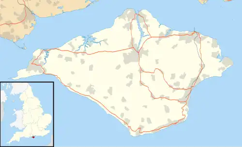
Upper Hyde is a small village and area of Shanklin, on the Isle of Wight, England. It is located in the civil parish of Shanklin and the Central Shanklin ward,[1][2] mainly on Upper Hyde Lane (unadopted name).[1][3]
Name
The name means 'the hide of land', from Old English hīd.[3] A hide usually totalled about 120 acres, and 1 family.[4]
~1280: Hyde
1289: la Hyde
1296: atte Hyde
1341: la Hide
1769: Upper and Lower Hide
Atte 'at the' was the surname of a person living there.[3]
History
In the Domesday Book, 3 landholdings named Scaldeford were recorded, totalling 1 hide. Reconstructed, this includes Upper and Lower Hyde farms (farms in the hamlet), Ninham Farm (in nearby Ninham) and the deserted site of Selbournes, with a total of 453 acres. It would have been part of an estate centred in Brading.[5]
The division into Upper and Lower Hyde dates from the 18th century.[3]
There are 3 grade II listed buildings in the village.[6]
References
- ^ a b "Area information for Upper Hyde Lane, Shanklin, PO37 7PR". StreetCheck.
- ^ "Isle of Wight (Unitary Authority, United Kingdom) - Population Statistics, Charts, Map and Location". www.citypopulation.de. Retrieved 4 January 2026.
- ^ a b c d Mills, A.D (1996). The Place-Names of The Isle of Wight. Shaun Tyas.
- ^ "Units: H". www.ibiblio.org. Retrieved 5 January 2026.
- ^ Margham, John (2 January 2019). "'The Hyde', Scaldeford and early medieval Wight". Landscape History. 40 (1): 35–58. doi:10.1080/01433768.2019.1600943. ISSN 0143-3768.
- ^ "Map Search | Search the List: Map Search | Historic England". historicengland.org.uk. Retrieved 5 January 2026.