East Peoria
East Peoria

Murray Baker Bridge
| Nom officiel |
(en) East Peoria |
|---|
| Pays | |
|---|---|
| État | |
| Comté | |
| Baigné par | |
| Superficie |
57,35 km2 () |
| Surface en eau |
9,88 % |
| Altitude |
149 m |
| Coordonnées |
40° 40′ 00″ N, 89° 32′ 00″ O |


| Population |
22 484 hab. () |
|---|---|
| Densité |
392 hab./km2 () |
| Statut |
|---|
| Code postal |
61611, 61635 |
|---|---|
| Code FIPS |
17-22164 |
| GNIS | |
| TGN | |
| Indicatif téléphonique |
309 |
| Site web |
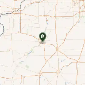
La ville d’East Peoria est située dans le comté de Tazewell, dans l’État de l’Illinois, aux États-Unis. Sa population s’élevait à 23 402 habitants lors du recensement de 2010, estimée à 22 561 habitants en 2018.
Démographie
| Historique des recensements | |||
| Année | Pop. | %± | |
|---|---|---|---|
| 1890 | 392 | — | |
| 1900 | 899 | ▲ +129,34 % | |
| 1910 | 1 493 | ▲ +66,07 % | |
| 1920 | 2 214 | ▲ +48,29 % | |
| 1930 | 5 027 | ▲ +127,06 % | |
| 1940 | 6 806 | ▲ +35,39 % | |
| 1950 | 8 698 | ▲ +27,8 % | |
| 1960 | 12 310 | ▲ +41,53 % | |
| 1970 | 18 671 | ▲ +51,67 % | |
| 1980 | 22 385 | ▲ +19,89 % | |
| 1990 | 21 378 | ▼ −4,5 % | |
| 2000 | 22 638 | ▲ +5,89 % | |
| 2010 | 23 402 | ▲ +3,37 % | |
| Est. 2018 | 22 561 | [1] | |
| U.S. Decennial Census[2] | |||
Notes et références
(en) Cet article est partiellement ou en totalité issu de l’article de Wikipédia en anglais intitulé « East Peoria, Illinois » (voir la liste des auteurs).
- ↑ (en) « Population and Housing Unit Estimates » (consulté le )
- ↑ (en) « Census of Population and Housing » [archive du ], Census.gov (consulté le )
Liens externes
- (en) Site officiel
- Ressource relative à la géographie :
- Ressource relative à la musique :
- Notice dans un dictionnaire ou une encyclopédie généraliste :
 Portail de l’Illinois