East Suffolk (district)
East Suffolk

| Pays | |
|---|---|
| Nation constitutive | |
| Région | |
| Comté non métropolitain | |
| Chef-lieu | |
| Superficie |
1 261,86 km2 () |
| Coordonnées |
52° 12′ N, 1° 30′ E |
.svg.png)

| Population |
248 249 hab. () |
|---|---|
| Densité |
196,7 hab./km2 () |
| Statut | |
|---|---|
| Assemblée délibérante |
Council of East Suffolk Council (d) |
| Fondation | |
|---|---|
| Remplace |
| Site web |
|---|
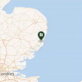
East Suffolk est un district non métropolitain du Suffolk, en Angleterre.
Histoire
Le district d'East Suffolk est créé le par la fusion des districts de Suffolk Coastal et Waveney.
Composition
Le district comprend les paroisses civiles suivantes :
- Aldeburgh (ville)
- Alderton
- Aldringham cum Thorpe
- All Saints and St Nicholas, South Elmham
- Badingham
- Barnby
- Barsham
- Bawdsey
- Beccles (ville)
- Benacre
- Benhall
- Blaxhall
- Blundeston
- Blyford
- Blythburgh
- Boulge
- Boyton
- Bramfield
- Brampton with Stoven
- Brandeston
- Bredfield
- Brightwell
- Bromeswell
- Bruisyard
- Bucklesham
- Bungay (ville)
- Burgh
- Butley
- Campsea Ashe
- Capel St Andrew
- Carlton Colville
- Charsfield
- Chediston
- Chillesford
- Clopton
- Cookley
- Corton
- Covehithe
- Cransford
- Cratfield
- Cretingham
- Culpho
- Dallinghoo
- Darsham
- Debach
- Dennington
- Dunwich
- Earl Soham
- Easton
- Ellough
- Eyke
- Falkenham
- Farnham
- Felixstowe (ville)
- Flixton
- Flixton
- Foxhall
- Framlingham
- Friston
- Frostenden
- Gedgrave
- Gisleham
- Great Bealings
- Great Glemham
- Grundisburgh
- Hacheston
- Halesworth (ville)
- Hasketon
- Hemley
- Henstead with Hulver Street
- Heveningham
- Hollesley
- Hoo
- Holton
- Huntingfield
- Iken
- Kelsale cum Carlton
- Kesgrave
- Kessingland
- Kettleburgh
- Kirton
- Knodishall
- Leiston (ville)
- Letheringham
- Levington
- Linstead Magna
- Linstead Parva
- Little Bealings
- Little Glemham
- Lound
- Lowestoft (ville)
- Marlesford
- Martlesham
- Melton
- Mettingham
- Middleton
- Monewden
- Mutford
- Nacton
- Newbourne
- North Cove
- Orford (ville)
- Otley
- Oulton
- Oulton Broad
- Parham
- Peasenhall
- Pettistree
- Playford
- Purdis Farm
- Ramsholt
- Redisham
- Rendham
- Rendlesham
- Reydon
- Ringsfield
- Rumburgh
- Rushmere
- Rushmere St Andrew
- Saxmundham (ville)
- Saxtead
- Shadingfield
- Shipmeadow
- Shottisham
- Sibton
- Snape
- Somerleyton, Ashby and Herringfleet
- Sotherton
- Sotterley
- South Cove
- Southwold (ville)
- Spexhall
- Sternfield
- Stratford St Andrew
- Stratton Hall
- St Andrew, Ilketshall
- St Cross South Elmham
- St James, South Elmham
- St John, Ilketshall
- St Lawrence, Ilketshall
- St Margaret, Ilketshall
- St Margaret, South Elmham
- St Mary, South Elmham
- St Michael, South Elmham
- St Peter, South Elmham
- Sudbourne
- Sutton
- Sutton Heath
- Sweffling
- Swilland
- Thorington
- Trimley St Martin
- Trimley St Mary
- Tuddenham St Martin
- Tunstall
- Ubbeston
- Ufford
- Uggeshall
- Walberswick
- Waldringfield
- Walpole
- Wangford with Henham
- Wantisden
- Wenhaston with Mells Hamlet
- Westerfield
- Westhall
- Weston
- Westleton
- Wickham Market
- Willingham St Mary
- Wissett
- Witnesham
- Woodbridge (ville)
- Worlingham
- Wrentham
- Yoxford
Liens externes
- (en) Site officiel
 Portail de l’Angleterre