Republican City
Republican City

| Nom officiel |
(en) Republican City |
|---|
| Pays | |
|---|---|
| État | |
| Comté | |
| Superficie |
0,84 km2 () |
| Surface en eau |
0 % |
| Altitude |
618 m |
| Coordonnées |
40° 05′ 52″ N, 99° 13′ 17″ O |

| Population |
134 hab. () |
|---|---|
| Densité |
159,5 hab./km2 () |
| Code postal |
68971 |
|---|---|
| Code FIPS |
31-41130 |
| GNIS |
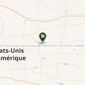
Le village de Republican City est situé dans le comté de Harlan, dans l’État de Nebraska, aux États-Unis. Sa population s’élevait à 150 habitants lors du recensement de 2010, estimée à 155 habitants en 2017.
Histoire
Republican City a été fondé en 1871.
Démographie
| Historique des recensements | |||
| Année | Pop. | %± | |
|---|---|---|---|
| 1880 | 282 | — | |
| 1890 | 428 | ▲ +51,77 % | |
| 1900 | 386 | ▼ −9,81 % | |
| 1910 | 476 | ▲ +23,32 % | |
| 1920 | 424 | ▼ −10,92 % | |
| 1930 | 417 | ▼ −1,65 % | |
| 1940 | 331 | ▼ −20,62 % | |
| 1950 | 580 | ▲ +75,23 % | |
| 1960 | 189 | ▼ −67,41 % | |
| 1970 | 179 | ▼ −5,29 % | |
| 1980 | 231 | ▲ +29,05 % | |
| 1990 | 199 | ▼ −13,85 % | |
| 2000 | 209 | ▲ +5,03 % | |
| 2010 | 150 | ▼ −28,23 % | |
| Est. 2017 | 157 | ||
| Groupe | Republican City |  Nebraska Nebraska
|
 États-Unis États-Unis
|
|---|---|---|---|
| Blancs | 100 | 86,1 | 72,4 |
| Autres | 0 | 13,9 | 27,6 |
| Total | 100 | 100 | 100 |
| Latino-Américains | 1,3 | 9,2 | 16,7 |
Selon l’American Community Survey, pour la période 2011-2015, 100 % de la population âgée de plus de 5 ans déclare parler anglais à la maison[3].
Notes et références
(en) Cet article est partiellement ou en totalité issu de l’article de Wikipédia en anglais intitulé « Republican City, Nebraska » (voir la liste des auteurs).
- ↑ (en) « Republican City, NE Population - Census 2010 and 2000 », sur censusviewer.com.
- ↑ (en) « Population of Nebraska - Census 2010 and 2000 », sur censusviewer.com.
- ↑ (en) « Language spoken at home by ability to speak English for the population 5 years and over », sur data.census.gov.
Liens externes
- Ressource relative à la géographie :
- Portail du Nebraska