Tangamandapio
Tangamandapio

Paysage de la municipalité.
| Nom officiel |
(es) Tangamandapio |
|---|---|
| Nom local |
(es) Tangamandapio |
| Pays | |
|---|---|
| État | |
| Chef-lieu | |
| Superficie |
315,68 km2 |
| Altitude |
2 m |
| Coordonnées |
19° 53′ 24″ N, 102° 27′ 00″ O |

| Population |
31 716 hab. |
|---|---|
| Densité |
100,5 hab./km2 |
| Statut |
|---|
| Code postal |
59920 |
|---|
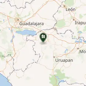
Tangamandapio est une municipalité de l'État du Michoacán, au Mexique[1]. En 2020, elle compte 31 716 habitants. Son chef-lieu est Santiago Tangamandapio.
Démographie
Localités
En 2020, la municipalité compte 25 localités[2].
Notes et références
(es) Cet article est partiellement ou en totalité issu de l’article de Wikipédia en espagnol intitulé « Municipio de Tangamandapio » (voir la liste des auteurs).
- ↑ (es) Instituto Nacional de Estadística y Geografía, « Panorama sociodemográfico de Michoacán de Ocampo. Censo de Población y Vivienda 2020 » [PDF] (consulté le ).
- ↑ (es) « Panorama sociodemográfico de México. Michoacán », Institut national de statistique et de géographie, (consulté le ).
Liens externes
 Portail du Mexique