Vandalia (Michigan)
Vandalia

| Nom officiel |
(en) Vandalia |
|---|
| Pays | |
|---|---|
| État | |
| Comté | |
| Superficie |
2,56 km2 () |
| Surface en eau |
0,06 % |
| Altitude |
268 m |
| Coordonnées |
41° 55′ 01″ N, 85° 54′ 53″ O |


| Population |
318 hab. () |
|---|---|
| Densité |
124,2 hab./km2 () |
| Code postal |
49095 |
|---|---|
| Code FIPS |
26-81680 |
| GNIS |
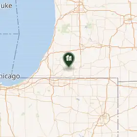
Le village de Vandalia est situé dans le comté de Cass, dans l’État du Michigan, aux États-Unis. Sa population s’élevait à 301 habitants lors du recensement de 2010, estimée à 290 habitants en 2017.
Démographie
| Historique des recensements | |||
| Année | Pop. | %± | |
|---|---|---|---|
| 1880 | 439 | — | |
| 1890 | 423 | ▼ −3,64 % | |
| 1900 | 407 | ▼ −3,78 % | |
| 1910 | 371 | ▼ −8,85 % | |
| 1920 | 331 | ▼ −10,78 % | |
| 1930 | 373 | ▲ +12,69 % | |
| 1940 | 360 | ▼ −3,49 % | |
| 1950 | 360 | ► 0 % | |
| 1960 | 357 | ▼ −0,83 % | |
| 1970 | 427 | ▲ +19,61 % | |
| 1980 | 447 | ▲ +4,68 % | |
| 1990 | 357 | ▼ −20,13 % | |
| 2000 | 429 | ▲ +20,17 % | |
| 2010 | 301 | ▼ −29,84 % | |
| Est. 2017 | 290 | ||
Source
- (en) Cet article est partiellement ou en totalité issu de l’article de Wikipédia en anglais intitulé « Vandalia, Michigan » (voir la liste des auteurs).
Liens externes
- Ressource relative à la géographie :
 Portail du Michigan